South West Coast Path
The Salt PathThe South West Coast Path is a 630-mile National Trail running from Minehead in Somerset, through north Devon, Cornwall and south Devon, to Poole in Dorset. For Ray and Moth, it is at once a physical route and a changing measure of what remains possible: its hills and beaches make the walk punishingly real, while its repeated forward steps offer direction after the loss of a home. The path does not simply lead across a landscape; in their account, walking it alters how distance, security and belonging are understood.
Route, origins and landmarks
The route’s history is presented as layered rather than singular. It is said to have been established for coastguards, who needed views into the coves and bays while patrolling for smugglers. Yet the ancient sites recorded in guidebooks and tourist pamphlets suggest that people had travelled across this terrain for far longer. Natural England funded the creation of the path as one continuous route, joining existing sections to form the country’s longest National Trail. The final section in north Devon was completed in 1978.
Its endpoints give the long route a visible beginning and finish. At Minehead, a monument of giant metal hands holding a map marks the start; Ray and Moth linger there, taking photographs and adjusting their packs before making the first step. At the other end, a marker post bearing the familiar white acorn records the 630 miles between South Haven Point and Minehead. A steel sculpture of a compass and sails also marks the end of the Coast Path. On a later return, the pair arrive by ferry from Poole and set out from the endpoint, turning what might once have been a finish into a beginning for the unfinished westward journey.
Maps, distances and decisions
The route’s scale is initially mediated by books, and those books prove unreliable guides to the experience on the ground. Ray rereads Five Hundred Mile Walkies, in which Mark Wallington had travelled the path with a borrowed rucksack and a scruffy dog, and takes encouragement from the apparent simplicity of that precedent. The direction of travel becomes a practical problem: the early stretch from Minehead to Padstow seems hardest, while the stretch from Plymouth to Poole seems easier. Ray considers walking from Poole toward Minehead to allow time to adjust before the more difficult ground. But available guidebooks follow the route north to south, not in the proposed reverse direction.
The chosen volume is Paddy Dillon’s The South West Coast Path: From Minehead to South Haven Point, a small book with a waterproof cover and an Ordnance Survey map of the whole route. Its handy size makes it fit Ray’s hand and Moth’s pocket, but its comforting practicality cannot make the distances manageable. Comparing it with the older account, Ray finds that the route is not 500 miles but 630. Once the pair begin above Minehead, the guide’s estimates are tested immediately: halfway up an excruciatingly steep zigzag through the woods, they have to stop on a bench, catch their breath and reread the instructions. The path’s actual gradient takes precedence over the page.
Route-following also involves choices about when not to walk. Near an urban stretch by an old quay, the path becomes pavement alongside the road for miles. The guidebook notes that walkers sometimes skip the section to St Ives by bus. With late afternoon approaching and no safe place to camp in the residential area after dark, Ray and Moth take the bus, using nearly all the money they have left for the fare. Elsewhere, a bus journey to Westward Ho! leaves Ray feeling as though the walk has been cheated. These detours expose the difference between a continuous line on a map and a journey shaped by time, money, shelter and the practical limits of the day.
The path as bodily and sensory experience
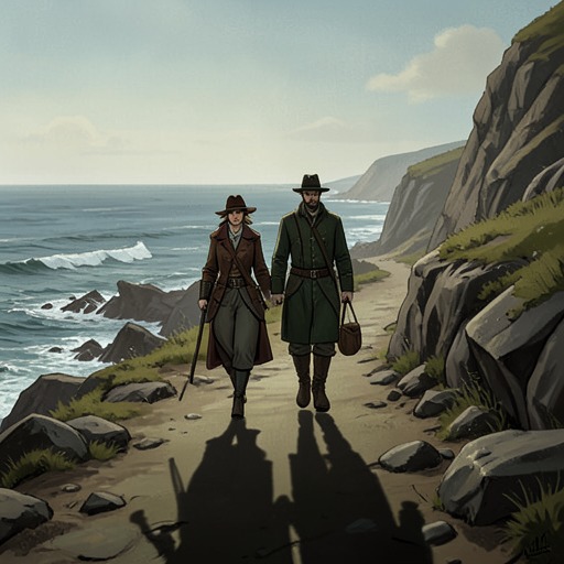
The route becomes legible through exertion. Legs, hips and shoulders ache on the climbs; exposed rock throws heat back at the walkers’ faces. On a high section, Ray describes the wind lifting beneath the rucksack and the exhilaration of height, with Wales visible in the distance. Moth walks with a lean away from the sea and toward the cliff, while Ray feels drawn into the open air and moves with a sense of release. The same landscape can therefore produce contrasting bodily responses without separating the pair’s shared progress along it.
Along the coast near Port Quin, the walking settles into a rhythm: pain and hunger soften into ache and thirst, then into a steady booming cadence beneath the sea’s sound. The place itself appears changed by the movement of its people. Port Quin, once home to fishermen, is now described as a scattered collection of weekend houses; local rumour says its fishermen went to Canada in pursuit of better catches, leaving lobster pots behind as garden ornaments. From the trail, the view behind records miles already passed, while the headlands ahead draw the walkers onward. At Stepper Point, they could have cut across toward Gunver Head, but their feet follow the path west. Trevose Head comes into view beyond it, with more headlands receding into mist.
Repetition gives this bodily journey a psychological force. As Ray and Moth walk, each climb out of a combe can register as a victory and each survived day as a reason to meet the next. The path becomes less a time for making plans than a concentrated sequence of steps, with attention narrowed to immediate effort, salt wind, dust and light. This does not erase illness or grief; rather, the physical rhythm changes how those burdens occupy the day. The route’s repeated demands supply a purpose that can be acted on one step at a time.
Homelessness, interruption and renewed direction
The Coast Path enters the story at a moment when walking is not simply recreation. In Taunton, Ray and Moth recognise that they are truly homeless: unlike travelling with a known home to return to, they have no door to go back through. The idea of walking the entire coastline initially feels as remote as escaping from the place where they are trapped. Reaching the Minehead start monument does not remove the fear or uncertainty. It gives them somewhere to go and a purpose for taking the first step, even though they are exhausted, frightened and confronting Moth’s illness.
That movement contains both compulsion and choice. The pair are without a settled home and have limited money, yet they also value being able to decide whether to continue, stop or move on. In one wet mid-September moment, they watch a bus leave and set off on foot, soaked and cold. Walking onward is not proof that their circumstances are easy; it is a way of retaining some control over what happens next. The contrast between chosen movement and having nowhere stable to stay remains present throughout their relationship with the trail.
The journey is also interrupted and resumed rather than completed in one uninterrupted sweep. After previously walking from Minehead toward Polruan, Ray and Moth return by ferry from Poole and begin again from the path’s eastern endpoint, heading west toward the point where their earlier route had stopped almost a year before. The marker records the full 630-mile distance, but the pair still have about 250 miles left to walk. Their return makes the end of the National Trail a starting point, and turns completion into a question of endurance and future steps rather than a simple finish-line moment.
As they approach the end of their homeless trail, the certainty supplied by the route becomes difficult to relinquish. Plymouth lies ahead as an urban threshold; beyond it, the familiar pattern of packing the tent and walking each day gives way to an unknown future. Ray and Moth are also approaching practical decisions about accommodation, while Moth’s university degree is due to begin in less than three weeks. Near the end, Ray and Moth sit above Lantic Bay at Pencarrow Head, their packs together, sharing the last of a packet of wine gums as a peregrine follows the cliff line and disappears from view. The trail’s end is bound up with the end of their homeless journey, but not with certainty about what comes next.
Belonging beyond the mapped route
The path’s significance finally exceeds its mileage. At first, the loss of a home and place within the world is experienced as something that cannot be accepted; walking supplies a way to keep moving while grief and denial remain unsettled. Over time, Ray describes a softer acceptance shaped by sun and storms. Belonging no longer depends on owning a patch of land: standing in the wind and feeling part of the earth, water and sky gives a different account of being at home.
The Coast Path thus holds together two meanings that cannot be collapsed into one. It is a marked National Trail with guidebooks, endpoints and a stated distance, but for Ray and Moth it is also a precarious lived route, altered by weather, exhaustion, illness, money and shelter. The final understanding is not that the landscape solves homelessness or guarantees a future. Rather, the walk leaves Ray with a choice about how to continue: the page left by loss may remain blank, or the story may go on with hope.